 |
| Looking down to Volos |
Distance: 9 km (+1 km to visit Mana spring)
Duration: 4 hours with stops (+0,5 h to Mana spring)
Altitude: from 95 m. (Aidonofolies) to 630 m. (Portaria)
Total ascent/descent: 625 m.
Signed with red paint marks and some signs
Drinking water on walk: yes
Download GPS track:
from Everytrail from Wikiloc
In this nice circular walk, starting from the outskirts of Volos, we climb through the kalderimis of Anakasia up to the village of Portaria and then come back through Stagiates. Aidonofolies is located in Upper Volos, at the end of Iolkou street next to the Mega Rema stream. We can go there by taxi or by city bus nr.4 (end of line). In case we want to make it easier avoiding climbing up, we can still go to Portaria by bus and walk down to Aidonofolies in less than 2 hours.
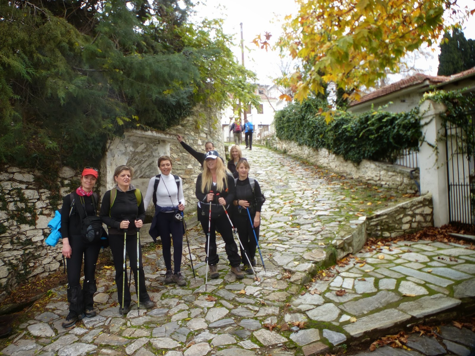
Starting from the parking lot at Aidonofolies, we walk up the stone paved track, which soon becomes concrete paved. On our left we go past the church of Timiou Prodromou (St. John the Baptist) and the local primary school. At two junctions we go right, keeping close to the main asphalt. Eventually, we reach the square of Anakasia, featuring a bronze statue of naive folk painter Theofilos who lived and worked there about a century ago (a visit to the Theofilos` museum that is nearby is recommended-open Mo-Fri 08.00-15.00, tel. 2421047340).
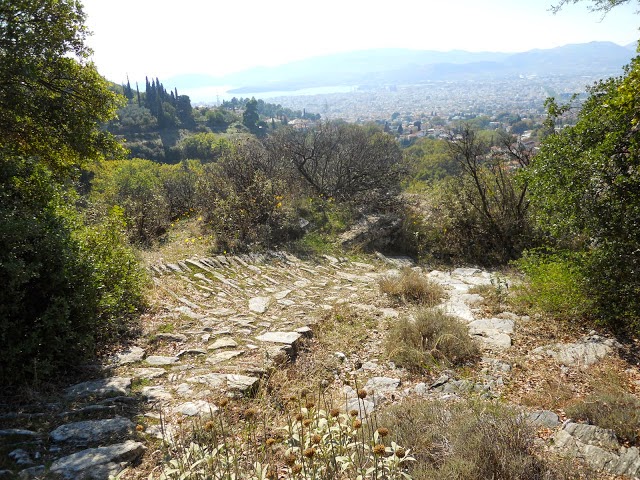
We continue on the stone paved track next to the drinking water fountain and head east, enjoying excellent view over the city of Volos and the sea down below. For some twenty metres the old cobblestone appears under our feet, but then gets covered again by the flat stone paving. Keeping an eye for the red paint marks, a little further up we take the uphill kalderimi to the left. Reaching a wooden sign pointing to the right, we elect to go left instead, up the stairs opening to the small square with the church of Agia Triada (Holy Trinity).
 |
| Agia Triada church |
Above the church we cross the asphalt and after an initial stretch of kalderimi, walk on a road to an easterly direction. After 200 m., we take the wide uphill kalderimi to the left. We pass under the main asphalt road, then next to Profitis Elias chapel and then join the asphalt road to Stagiates village, which we follow to the left uphill. After crossing a stream, we take the uphill earth road to the right. As we climb, we notice stretches of kalderimi in the road. Further up, it becomes stone paved and we go past a drinking water fountain. We cross the main asphalt and continue uphill on a track, entering the village of Portaria.
 |
| On the stone paved tracks of Portaria |
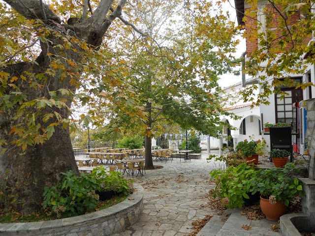
We cross the asphalt yet twice, walking now on stone paved track. At the corner of restaurant ''Geusokratoras'' we take the narrower kalderimi to the left, which opens to the main asphalt again, just above Naoumidi old mansion-guesthouse. We go downhill on the asphalt for a few metres and through the parking lot, then on the stone paved track opposite, which gets at the upper side of the village square, next to the old hotel ''Theoxenia''. So far, we have walked 4,5 km in about one hour and 50 minutes, including stops.
 |
| Portaria village square |
After a refreshing stop at the quiet square of Portaria, under the shade of the plane trees, we go down on the asphalt and turn right to Makrinitsa. In a short while, as we reach the stream of Mana, a short deviation from our course is recommended, a 15-minute climb following the course of the overgrown ravine to the homonymous spring of Mana, In our course we pass over 9 small wooden bridges. Pelion`s nature is at its best here.
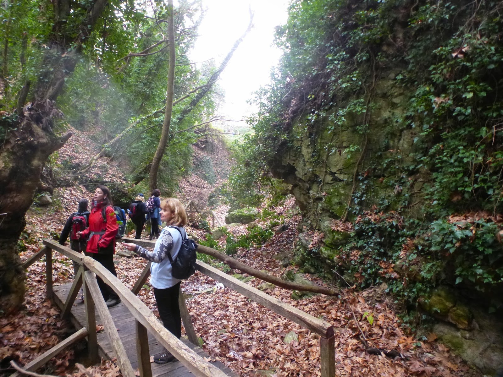 |
| Walking into the ravine to Mana spring |
Coming back to the asphalt, we continue walking towards Makrinitsa and pass by the drinking water fountain of Adamena. As we reach the cemetery and a shrine on the right side of the road, we find a path ot the left side (there is a walking sign on a tree) that goes downhill and opens to a narrow asphalt road, which we follow for fifty metres. Then, seeing a basketball pitch on the right, we find the path again to the left on a southwesterly direction. It soon becomes a kalderimi, having a fence on the left side. Further down it opens to a concrete track and we keep on the same direction. We pass next to a tank of the water system, walking now through olive groves. At a junction we go left.
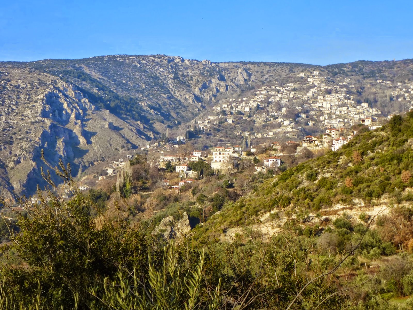 |
| View over Makrinitsa |
In a while, our path opens to a concrete road at an angle as we come across the first houses of Stagiates. Soon it becomes a kalderimi again, descending through the village. Crossing the asphalt, we immediately reach the square. A stop is mandatory here, under the shade of the two big plane trees, to quench our thirst with the cool water running from the fountain of the square, as we try to read the old inscription in arabic letters, dating from the Ottoman era.
 |
| Stagiates village square |
The kalderimi continues downhill on the left side of the square. Reaching an earth road junction we go right, pass by the small chapel of Agios Serafim, and further down there is a sign on the left, which indicates the continuity of the kalderimi.
 |
| View over Volos |
Enjoying great views over Makrinitsa and Volos, we pass by the quiet small chapel of Agios Panteleimon and then the path opens to an earth road. At the sharp right bend we go straight ahead to find a short final section of the kalderimi, opening to an earth road parallel to the Mega Rema stream on our right. Further down, we pass to the right bank of the stream over a concrete bridge and soon return to the starting point of our walk.


No comments:
Post a Comment